
Science Highlights
-
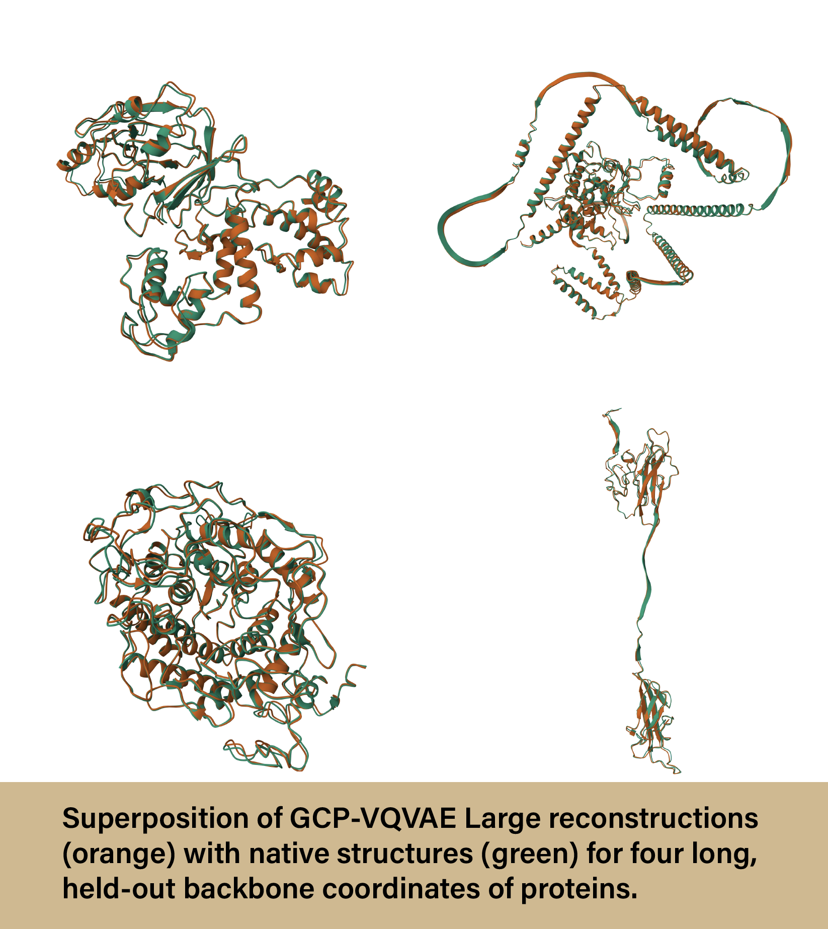
Bioinformatics researcher uses Anvil AI to advance field and present at NeurIPS 2025
A research group from the University of Missouri recently used Purdue’s Anvil supercomputer to train a deep learning model to represent three-dimensional protein structures that are effective in downstream bioinformatics tasks. The new model not only...
-
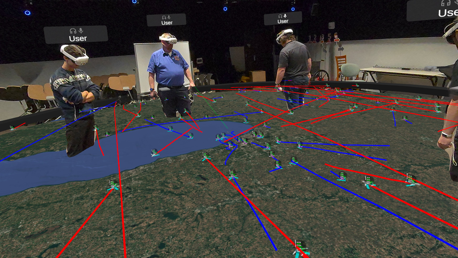
Purdue University’s Envision Center and the School of Aviation and Transportation Technology are exploring Extended Reality (XR) visualization technologies for use in airport ground operations training, as well as studying challenges with existing di...
-

WHPC Scholarship sends student to 2026 Game Developers Conference
Purdue’s Women in High-Performance Computing (WHPC) group offers scholarships to support students who wish to travel to major computing conferences. Recently, the group sponsored a graduate student to attend the 2026 Game Developers Conference (GDC)...
-
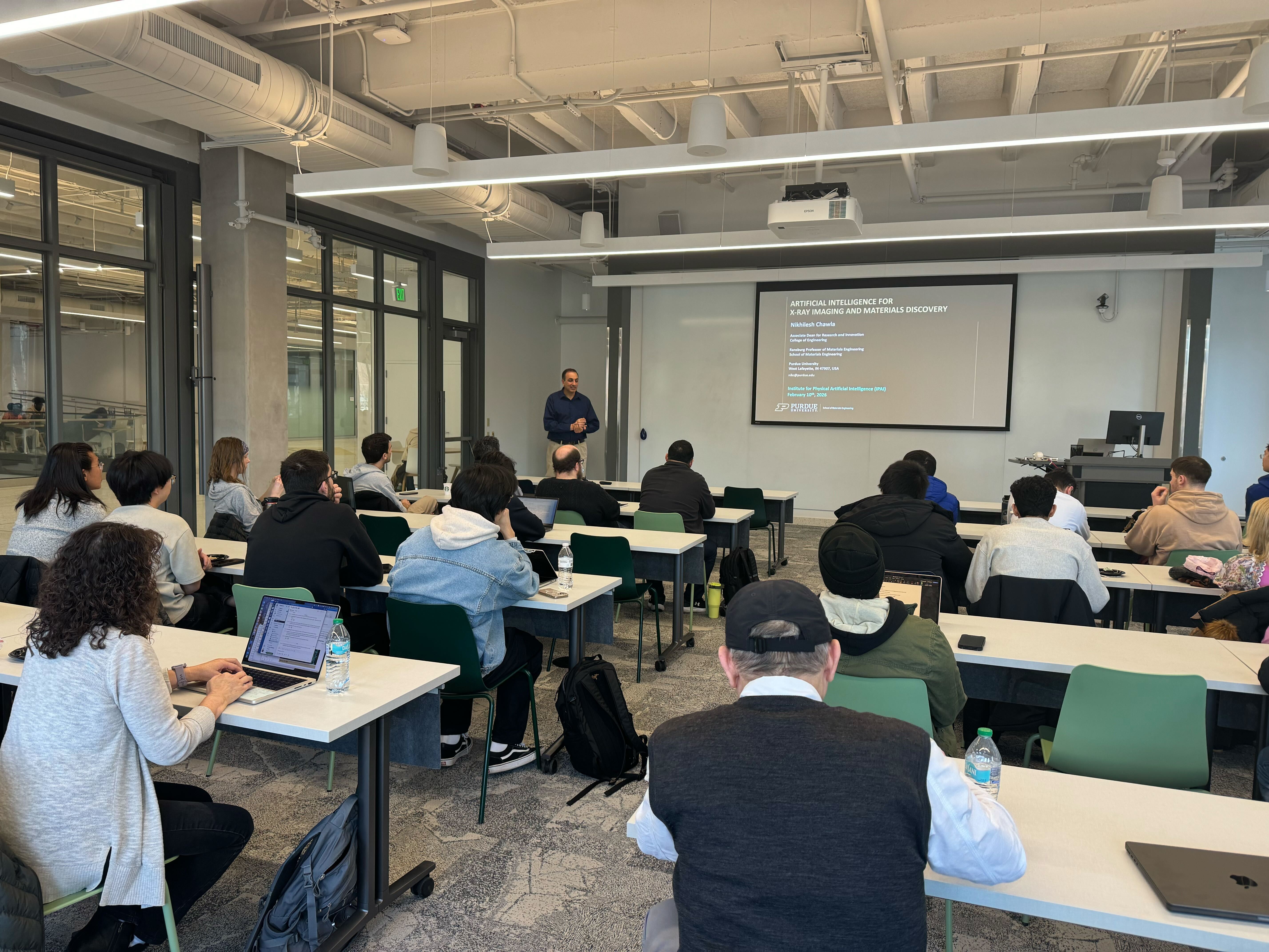
RCAC and IPAI faculty seminar series on AI proves successful
The Rosen Center for Advanced Computing (RCAC), in collaboration with Purdue’s Institute for Physical Artificial Intelligence (IPAI), has successfully introduced a new seminar series dedicated to advancing AI at the university. The new series, titled...
-
Advancing AI at Purdue: 2025 in Review
Throughout 2025, the Rosen Center for Advanced Computing (RCAC) made a concerted effort to expand the artificial intelligence (AI) resources available to Purdue at large. By enhancing the infrastructure, support, and training for AI and generative AI...
-
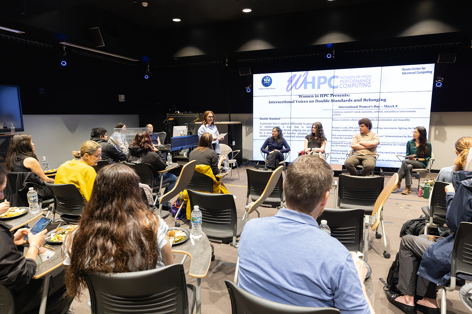
Purdue WHPC group hosts discussion exploring bias and double standards
The Purdue Women in High-Performance Computing (WHPC) chapter recently hosted a workshop and panel discussion that delved into how double standards and bias shape belonging in computing and HPC. The event, titled “Women in HPC Presents: Intersectiona...
-

Scientific workflow management system, Pegasus, available on Anvil
Pegasus, an NSF-funded scientific workflow management system, is now available for use on Purdue's Anvil supercomputer. With the addition of Pegasus, Anvil users can define, manage, and execute complex, multi-step computational tasks with ease throug...
-
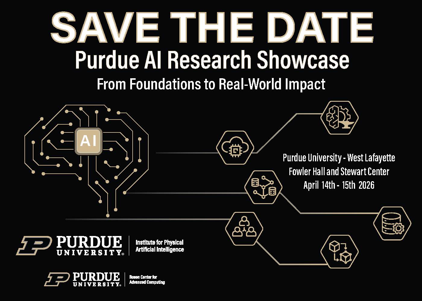
Purdue AI Research Showcase to take place in April
The Institute for Physical AI, in partnership with the Rosen Center for Advanced Computing, is organizing a campus-wide event designed to bring together AI experts, practitioners, and learners to showcase the groundbreaking work emerging at Purdue, a...
-
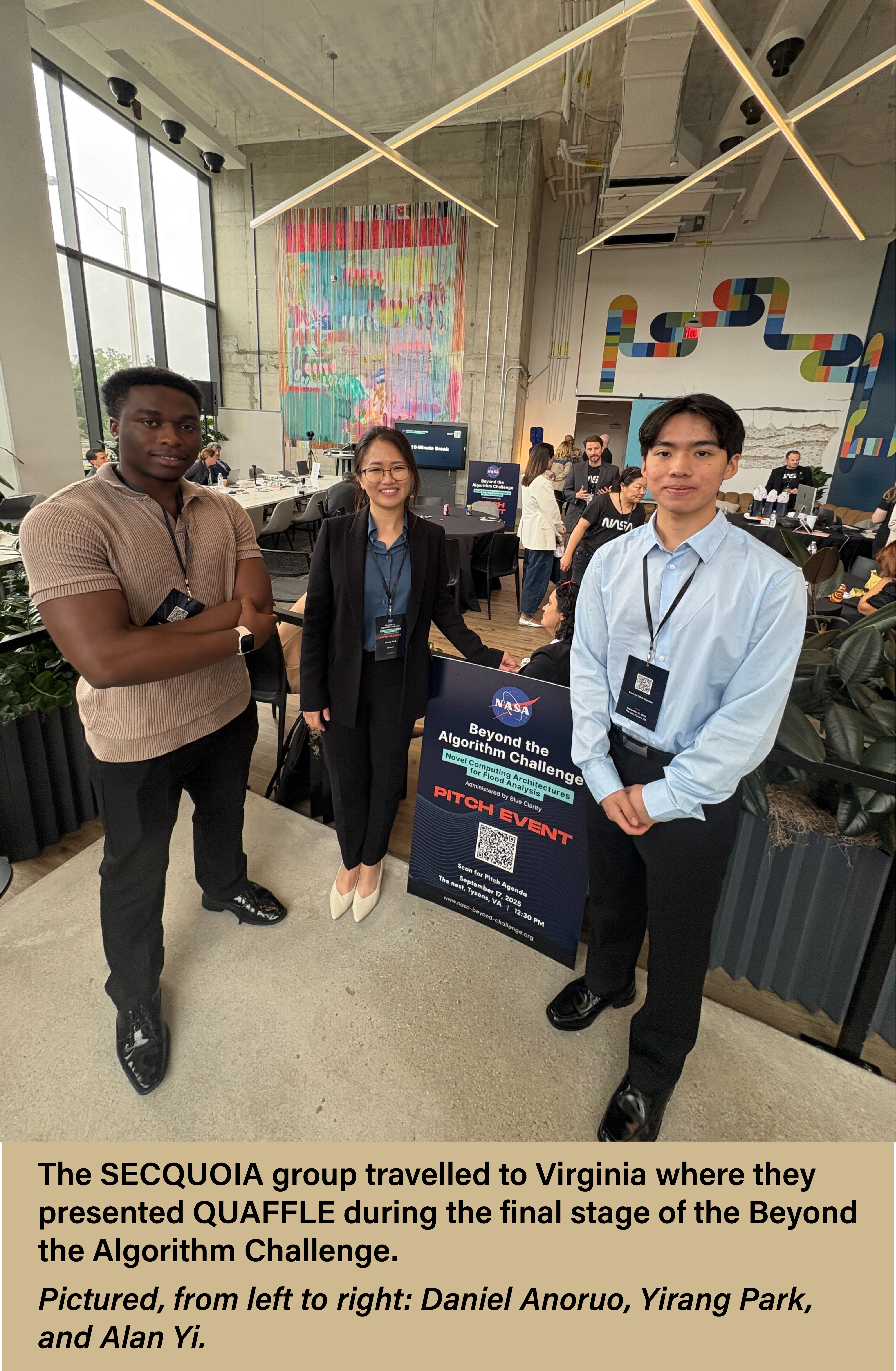
Purdue research team uses Anvil to secure position as finalist in NASA competition
A research group from Purdue University used the Anvil supercomputer to compete in NASA's Beyond the Algorithm Challenge, a nationwide competition aimed at improving flood analysis with emerging technologies. The team from the SECQUOIA (Systems Engin...
-
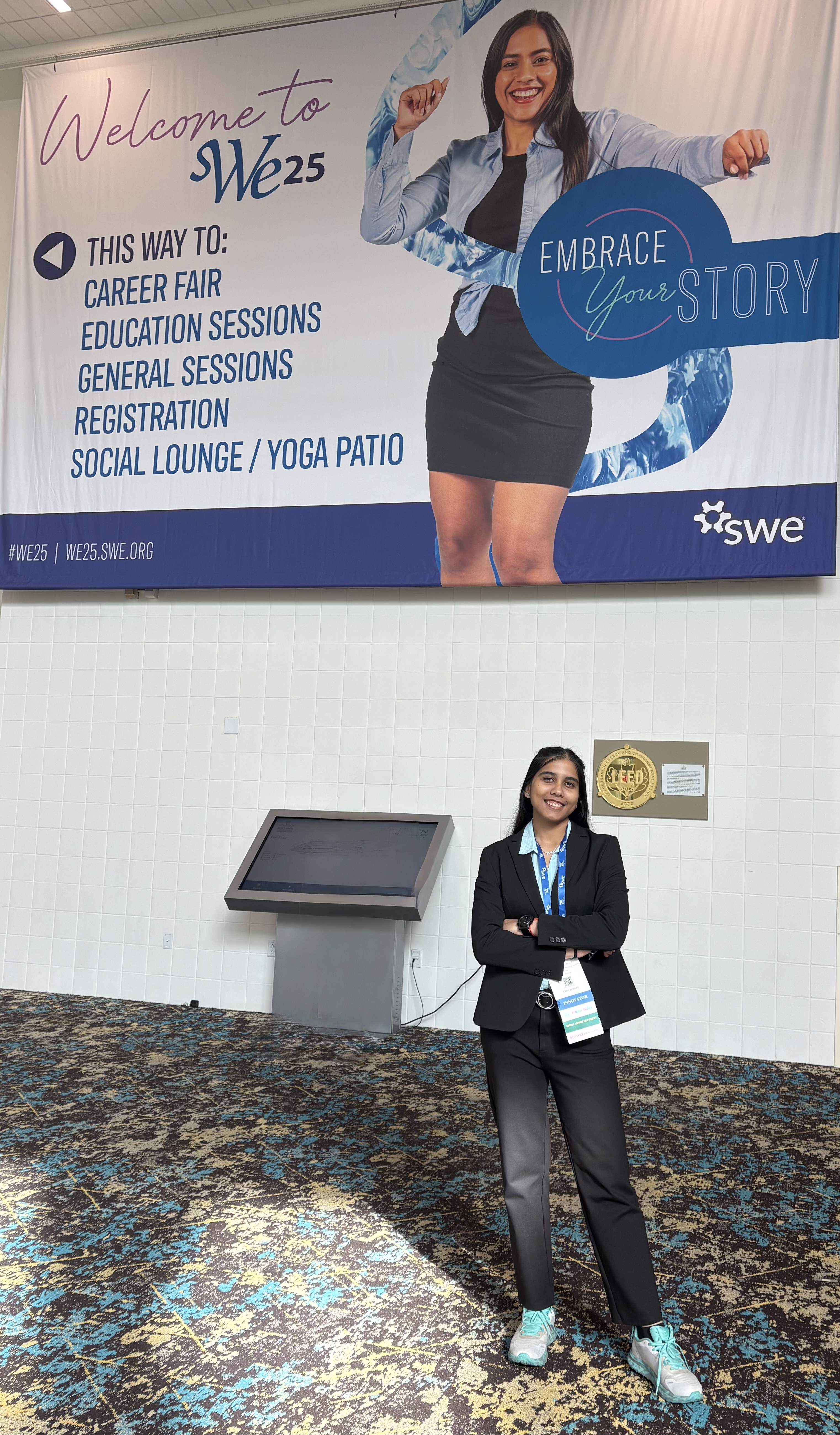
Purdue student attends WE25 conference with WHPC Scholarship
Purdue’s Women in High-Performance Computing (WHPC) group offers scholarships to support students who wish to travel to major computing conferences. Recently, the group sponsored a graduate student to attend the WE25 conference, held in New Orleans,...
-

RCAC Student Spotlight : Nathan Whitacre
Name: Nathan Whitacre Year: Senior Major: Computer Science Position: Student Programmer Can you introduce yourself and share a little about who you are? Hello! My name is Nathan Whitacre and I’m a senior working at RCAC as a student programmer....
-
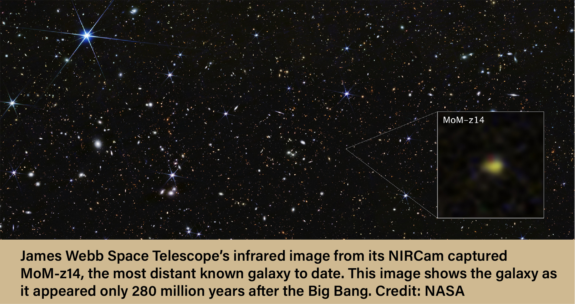
Anvil used to study dark matter and early universe formation
Purdue University’s Anvil supercomputer was used by researchers from the University of California, Los Angeles (UCLA) to study the effects of dark matter on galaxy formation in the early universe. This research, part of the Supersonic Project, aims t...
-

Purdue WHPC scholarship sends student to GHC 25 conference
Purdue’s Women in High-Performance Computing (WHPC) group offers scholarships to support students who wish to travel to major computing conferences. Recently, the group sponsored a graduate student to attend the Grace Hopper Celebration (GHC) 2025, h...
-

Purdue researcher collaborates with Envision Center on INDOT driving simulator
A Purdue University researcher recently partnered with the Rosen Center for Advanced Computing’s (RCAC) Envision Center to develop a driving simulation platform for the Indiana Department of Transportation (INDOT). This platform allows users to test-...
-

RCAC Student Spotlight : Elian Rieza
Name: Elian Rieza Year: Sophomore Major: Electrical Engineering Position: Assistant Computational Researcher Can you introduce yourself and share a little about who you are? Hello! My name is Elian and I’m an Assistant Researcher! What are some of y...
-
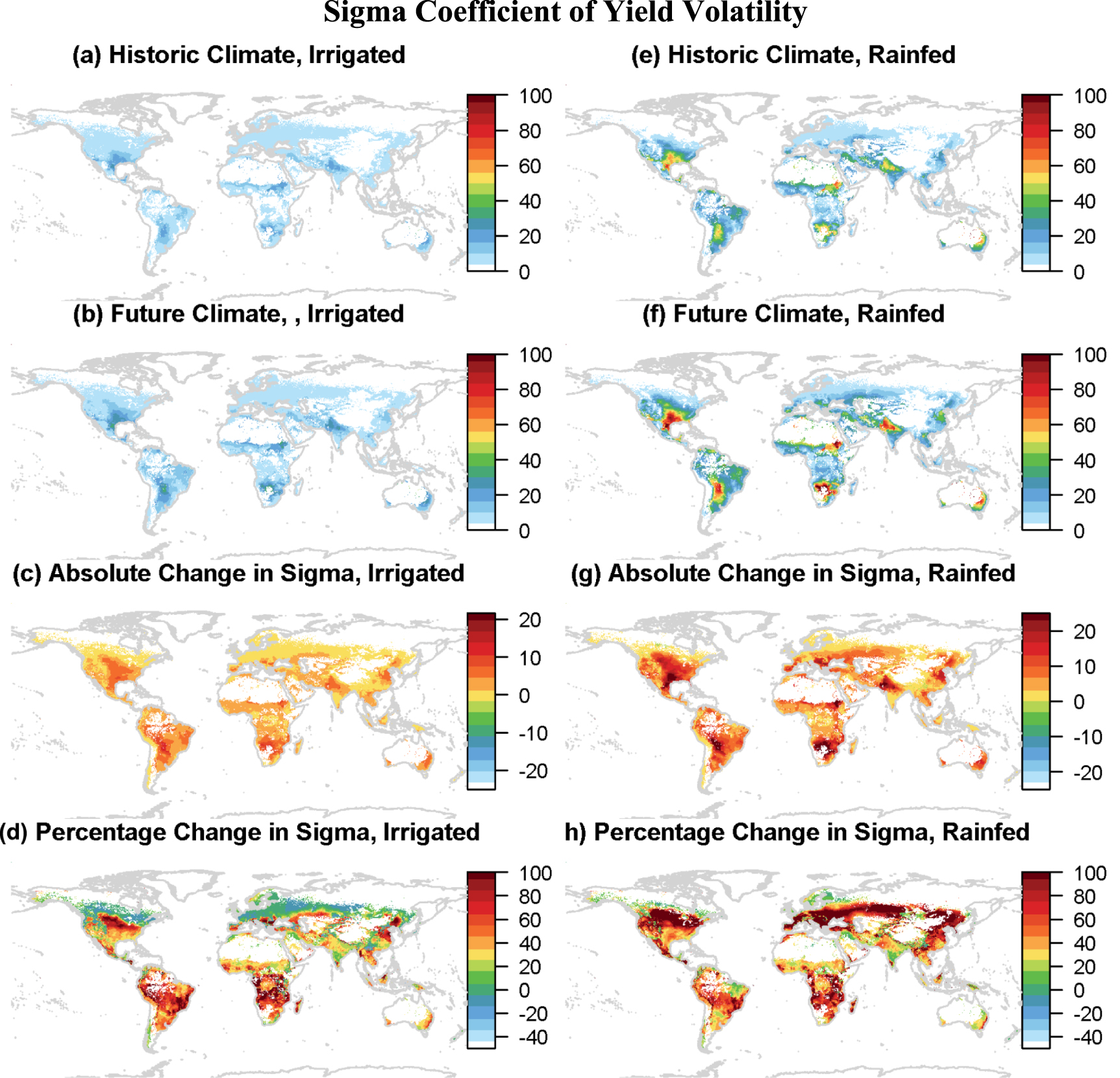
Anvil used to study how trade can reduce volatilities in crop supply
A researcher from Purdue University used the Anvil supercomputer to study climate-induced volatility in crop production and identify the role of potential adaptation strategies for reducing future risk. The results of this research, notably that inte...
-

Annual Review: RCAC support for life sciences in 2025
Throughout the past year, the team at the Rosen Center for Advanced Computing (RCAC) has been dedicated to expanding the training and cyberinfrastructure available for life sciences research at Purdue. The goal of these new initiatives is to build a...
-

RCAC Student Spotlight: Samuel Gomez
Name: Samuel Gomez Year: Senior Major: Data Analytics, Technologies, and Applications Position: Research Solutions Engineering Student Can you introduce yourself and share a little about who you are? Hello! My name is Samuel Gomez, and I’m a Data Ana...
-
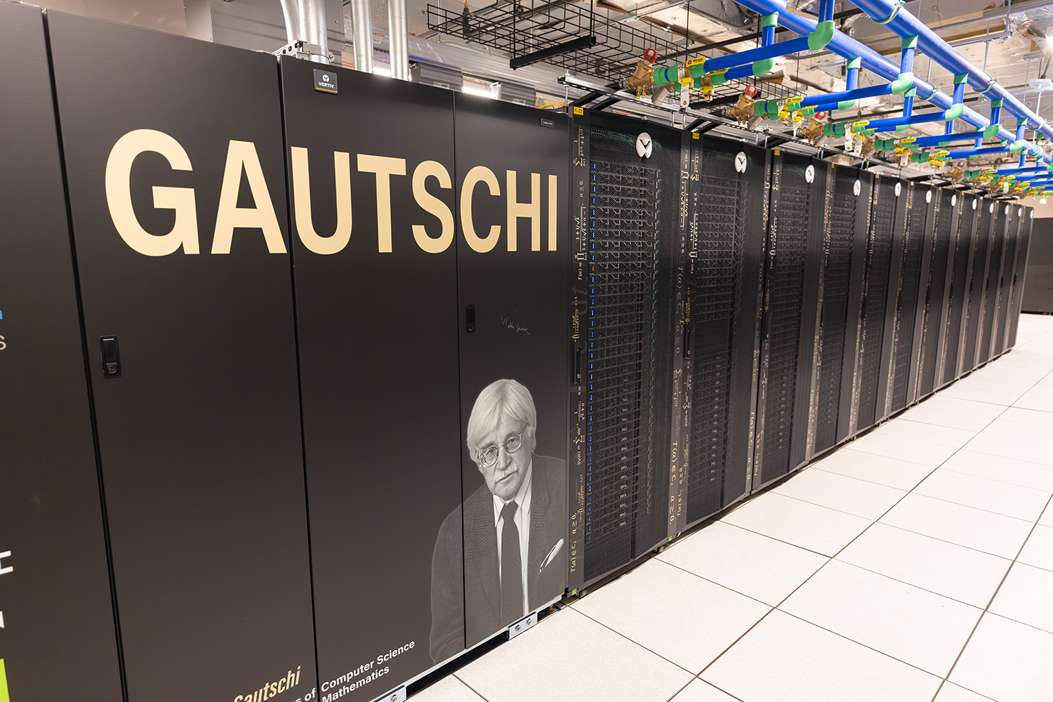
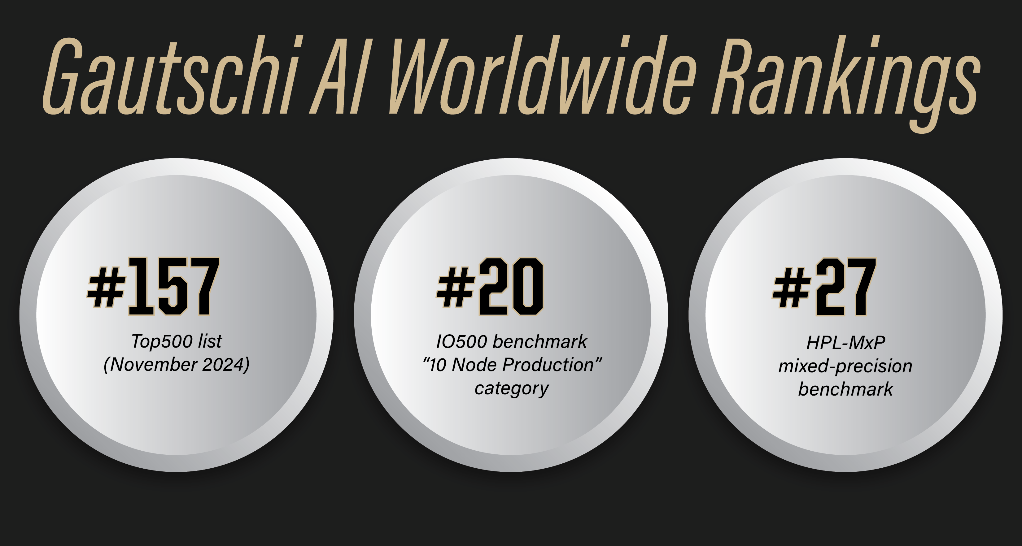
Gautschi Community Cluster ranks high in international benchmark competitions
Gautschi, Purdue University’s most powerful supercomputer, was recently ranked among the top high-performance computing (HPC) systems on two separate, international benchmarks. The community cluster ranked 20th on the IO500 benchmark in the “10 Node...
-

Anvil and AI used to solve for best taxation strategies
A researcher from the University of Nebraska-Omaha used Purdue’s Anvil supercomputer to develop a new artificial intelligence (AI) technique that can derive optimal taxation strategies for governments. This new method leveraged Anvil’s advanced GPUs...